Tech Tip: Opening Elevation in a Summit Project
By Alissa Oder
The opening elevation of a Summit project is very important. Having it set near the actual ground elevation helps in many ways, for example:
- Summit correctly calculates the model's stereo extents
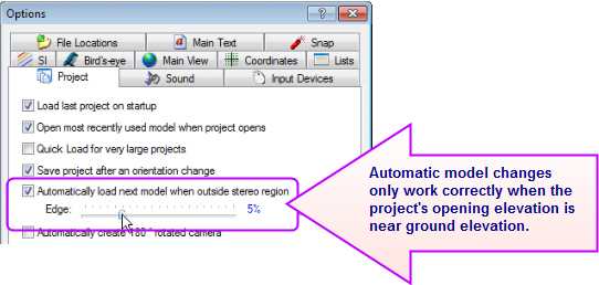
- "Automatically load next model..." changes models at the right place near the edge of the model
Vector superimposition in 2D views lines up better with imagery.

Note that Ortho+Mosaic is a 2D view. Superimposition (x,y) positioning is always estimated in 2D views. It will never line up exactly, but it can be made better with the correct opening elevation in the project.
Summit does its best to find a good opening elevation for stereo projects if one isn't provided. In some types of stereo projects, such as ADS40/80/100, the provided elevation found in the project files is wrong. For ADS40, use a “Fake Control File” if a real control file doesn’t exist for the project; set a point in it to the estimated average ground elevation of the project.
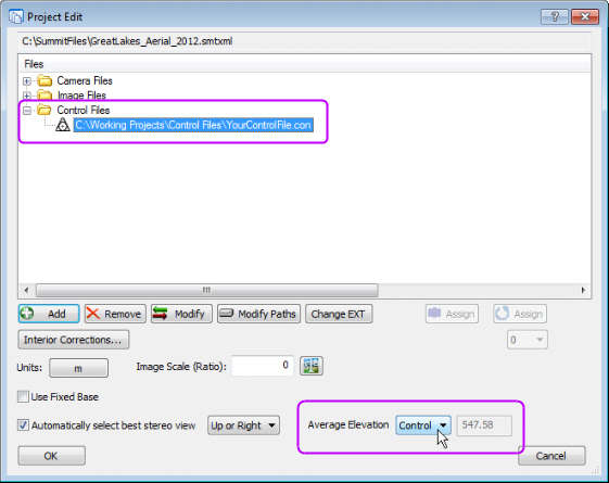
In an aerial project, the opening elevation method is selected in the "Average Elevation" setting located in the Project Edit dialog. There are two methods: Control File and Key-in.
• Control File automatically calculates the average Z value for points that have a Z component in the control file. It only works if there is a control file added to the project.

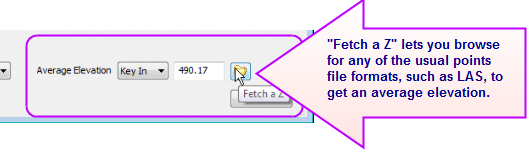
• Key-in lets you either key in an estimated elevation or browse for a DEM points file to calculate the value.
 If you change the “Average Elevation” setting, save the project. The next time Summit opens a model in the project, it will open at the value you selected.
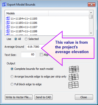
When the model opens much closer to ground elevation, you'll notice improvement in automatic model changes near the edge of the stereo area and the SI displays in 2D views such as Ortho+Mosaic. It will also improve other commands in subtle ways, such as the default elevation offered in Export Model Bounds:
Comments are closed.