Tech Tip: Drape Superimposition and Elevate Layers
What should you do if your existing vector objects either lack elevation or have elevation set to the wrong values?
First, if the vector objects have varying elevations (not all zero), but they seem to be the wrong elevation, be sure their coordinates aren’t expressed in a different coordinate system. Changing the elevation values will not fix incorrectly projected data. You may find that the (x,y) values are also off if they are not in the right coordinate system.
If the (x,y) values are correct, but you have a source of better Z values, you can create new layers with the Z values replaced in our DAT/EM Capture software. With DAT/EM Capture for ArcGIS®, you can also drape the vectors into 3D superimposition in real time based on the elevation source.
1. DAT/EM Capture for ArcGIS has two tools: an on-the-fly superimposition drape (SI drape) tool and "Elevate Layers" to add the elevations to a new 3D version of a 2D layer. SI Drape can also be used to drape 3D layers when the DTM/DEM file provides better Z values than exist in the original 3D data.
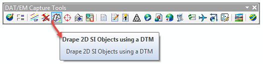
A) SI Drape is located on the DAT/EM Capture Tools toolbar:
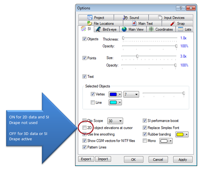
When Drape is active, be sure to use 3D superimposition in Summit. That is, Summit>Tools>Options>SI tab>"2D - object elevations at cursor" should be off.
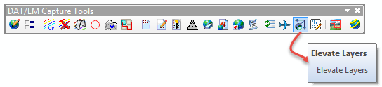
B) Elevate Layers is also on the DAT/EM Capture Tools toolbar on the ArcGIS side.
This allows you to input your 2D (or 3D with elevations that need to be improved) and a DTM/DEM (elevation source) file. It does not change the existing layer. It outputs a new layer. Be conservative with the number of characters or special characters you enter for the name change, because the whole name must conform to ArcGIS naming rules.
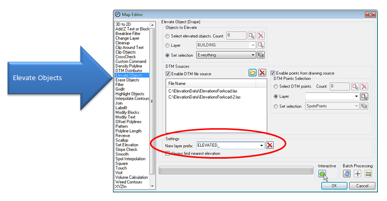
2. DAT/EM Capture for AutoCAD® doesn't have an on-the-fly SI Drape tool. The AutoCAD MapEditor contains the "Elevate Layers" command. The keyin is MAPED and the tool name is "Elevate Objects". The idea is the same as for ArcGIS: It doesn't change the input layer, but instead makes a new layer named with a prefix. If you hover the mouse over the settings, it will give a tooltip describing the setting.
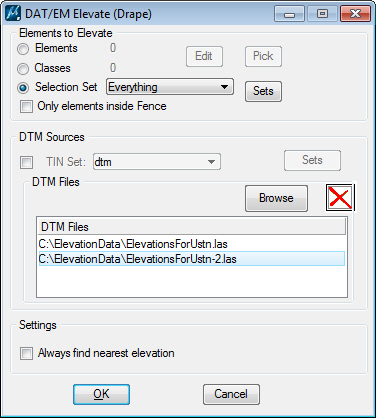
3. DAT/EM Capture for MicroStation® doesn't have an on-the-fly SI Drape tool. Instead, DAT/EM applications provide the keyin command, ELEVATE. Unlike DAT/EM Capture for ArcGIS and AutoCAD, this command directly edits the vector data on the original levels. It is meant to work like other DAT/EM MapEditor commands, which directly edit the vectors. If you would like a copy of the original objects, back up the vector file before you begin.
Comments are closed.