Google Maps Tool Fixed
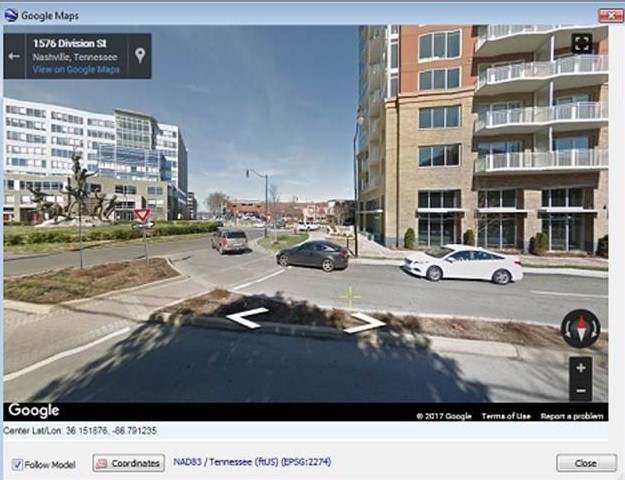
Good news! Summit’s Tools > Google® Maps tool is fixed, even for previous releases of Summit. If you tried it in the past year, you will be familiar with the script error messages that happened every time the system mouse passed over the Google Maps window. This error prevented Street View from working. Now you can use it without errors and in Street View, as long as Street View is available in the area.
- The first time you try Summit > Tools > Google Maps, make sure the Google Maps window has Windows focus, then press F5 once or twice. This forces a refresh.
- If you still get script errors when mousing over the Google map area, move the mouse off the window. Hold down “N” for “No” until the errors are finished. Move the mouse around the window (staying outside the window) and approach the window’s title bar from above. Click on the title bar without mousing over the map area. Press F5 again.
- It will only work with an active Internet connection.
- Google Street View must be available in the area of the Summit project in order to work. If it is not, it will automatically set itself back to map view.
- Use the system mouse to activate Street View and change the viewpoint.
- If Summit’s cursor moves, so will the Street View center.
- Remember that Street View and Summit’s cursor will never be at exactly the same place on the ground. The offset will be approximately 10 to 50 meters. This is normal and can’t be reduced.
- Unless you have the very latest v.7.5 beta, you might need to manually resize the view window.
- You must set at least an input coordinate system in Summit > Orientation > Coordinate Conversion before the Google Maps tool will work.
Comments are closed.