

As a UAS post-processing toolkit, Summit UAS gives users control over their data. Summit UAS consists of two powerful applications, Summit Evolution Lite and LandScape, which among their many features offer ways to further explore and edit the point cloud and orthomosaic created by UAS processing software. The two products can be used separately to visualize and alter data or together to superimpose a point cloud onto stereo or orthomosaic imagery for targeted digitizing and editing tasks. Summit UAS is the right choice to explore and analyze your UAS data in 3D stereo and capture that understanding as fully-georeferenced 3D points and vectors.
Summit UAS Toolkit Includes:
- LandScape: Visualize and explore in 3D stereo; edit enormous 3D terrain point clouds; quickly switch between point views; edit points based on the view; use a wide variety of automatic and interactive tools; enhance the understanding of your data by creating, modifying and classifying points as well as reviewing and updating existing drawings based on those points.
- Summit Evolution Lite: View an aerial, satellite or UAS project in 3D stereo; measure and understand the contents of the Earth’s surface; Capture 3D vectors directly into a companion vector editor such as ArcGIS®, MicroStation®, GlobalMapper® and AutoCAD®. Leverage the 3D power of your vector editor with stereo.
- LandScape + Summit Evolution Lite: The integrated Summit UAS environment uses both applications together to enable simultaneous viewing of the point cloud superimposed over the stereo pairs or orthophoto.
For optimal use, Summit UAS requires a third-party UAS processing package to create an orthomosaic and point cloud or DEM from the UAS imagery. Summit UAS has direct project and camera import tools for all major third-party UAS software packages, and maintains an open policy regarding support for others. Contact us for a current list or view our integrations page.
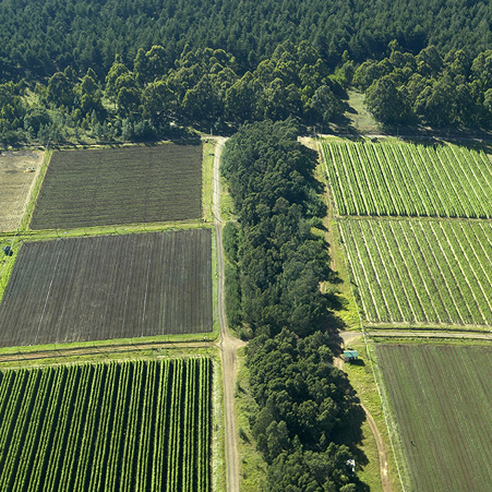
- Farming: determine crop yields; conduct fertility time analyses; evaluate biomass and health assessments.
- Forestry: perform harvest time analysis, stand typing or revegetation planning.
- Surveying: inspect remote areas; validate data.
- Mineral Extraction: show stockpile inventory; monitor mine conditions and environment.
- Conservation: monitor and analyze hazardous, remote and/or inaccessible regions.
- Utilities: assess utility corridor infrastructure; monitor vegetation encroachment.
- Transportation: measure and evaluate signage; determine surface defects.
- Emergency Response: develop emergency preparedness schemes; display situational awareness; conduct hazards mapping.
Interested in trying Summit UAS? Visit our Request a Demo page.
To meet the needs of the rapid deployment and data processing of UAS projects, DAT/EM Systems International brings the world-famous Summit Evolution technology to the world of UAS. Summit UAS contains simple and mobile tools to critically examine and compare UAS data by drawing, viewing, editing and defining features. Summit UAS requires no training in photogrammetry and is tailored to resource-grade data analysis. 3D feature collection may be done in either a stereo or non-stereo environment. With either viewing option, Summit UAS is the right choice to explore and analyze your UAS data and digitize accurately georeferenced 3D vectors.
Summit Evolution – Feature Comparison 2017
| Professional | Feature Collection | UAS | Lite | Mobile | |
|---|---|---|---|---|---|
| Vector Superimposition | |||||
| Terrain following and Z digitizing based on DEM files | |||||
| One-year system support included | |||||
| 3D Stereo Enabled | |||||
| Capture add-on for MicroStation, AutoCAD, ArcGIS or Global Mapper | |||||
| LandScape Included | |||||
| LandScape Integration | |||||
| Built-in drawing and editing tools | |||||
| Dedicated 3D input device enabled | |||||
| Advanced 2D and 3D editing, snapping, attribute handling | |||||
| MapEditor automated editing software for AutoCAD or Microstation | |||||
| Terrain Visualizer | |||||
| Contour Creator | |||||
| Point Translator | |||||
| Project Status Tracker | |||||
| Ortho+Mosaic | |||||
| Airfield3D for ArcGIS | |||||