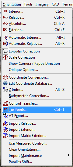
Tech Tip: Single Photo Resection
The world of photogrammetry is an interesting place. There’s always something new, a different requirement for a client, or a different way to produce the map data needed quickly and effectively.
While unusual, it is sometimes necessary to work with a single photograph or image instead of a conventional stereopair or a full block of models.
Known as Single Photo Resection, this process makes it possible to orient and exploit a single photo in Summit Evolution Professional. Observe an Interior Orientation as usual, and then observe a minimum of 3 control points in the image of interest. Once control has been measured, an Absolute Orientation of the image can be calculated, resulting in Exterior Orientation values for X, Y, Z and Omega, Phi and Kappa.
Once the image has an Exterior Orientation, you can then orthorectify the image, add an existing DEM and use Summit Evolution Terrain Following to digitize features in non-stereo 3D by draping your line or points on the DEM as guided by the ortho image.
To complete a Single Photo Resection in Summit Evolution Professional, select a single image from the project window. Open the Tie Points dialog, click the Control button, select the control points of interest, select Done and then select and measure the control points visible within that image.
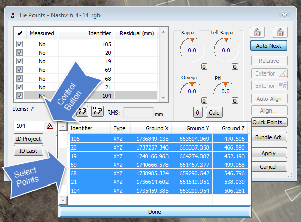
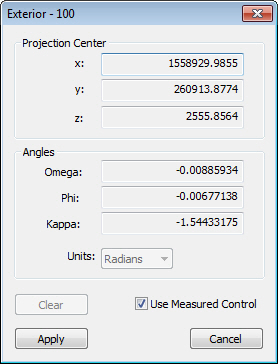
Once control has been measured, select the Apply button and Summit Evolution will calculate the exterior orientation parameters for that image alone. This can be checked by closing the Tie Points dialog, then selecting Exterior Orientation from the Orientation pulldown menu or from the toolbar. This will open the Exterior dialog box, and you should see a projection center X,Y and Z, with Omega Phi and Kappa angles. Make sure the Use Measured Control button is not checked if you do not see any values for the image.
If you don't have known ground control points for the image, an alternative method uses Summit Professional's Control Transfer tool. For Control Transfer, an external source of (x,y) and (z) coordinates in the same geographic area will be necessary, such as a second Summit project, an orthophoto with a DEM file, or a 3D vector file. We can talk more about Control Transfer in a future tech tip.
It’s not used often, but when you need to orient a single image and have control available from another source, you can easily position the image in space, orthorectify the image and then use various Summit tools to exploit the orthoimage as necessary.
Comments are closed.