DAT/EM Photogrammetric Suite Version 7.4 Now Available
The time has come! The DAT/EM Photogrammetric Suite version 7.4 is now available. This exciting release includes a beta version of DAT/EM Point Cloud VR, updated project import compatibility for Summit Evolution, new comparison tools in LandScape and more. We’ve sent an email with upgrade instructions to everyone who has an active support contract. Please contact your reseller or support@datem.com if you have any questions about the update or to renew your support contract.
Here are some of the many highlights from V7.4.
DAT/EM Point Cloud VR™ is almost ready for prime time and we are offering beta trials to our current customers. View the desktop and CAD or GIS window, snap to points and surfaces, and digitize 3D vectors while virtually flying around a point cloud. An Oculus Rift® Virtual Reality headset with Touch controllers is required to become a beta tester. If you are interested in being a beta tester with a demo of Point Cloud VR, please contact sales@datem.com.

You could beta test DAT/EM Point Cloud VR
Summit Evolution
Updated Summit Evolution project import tools:
- Summit’s Pix4D import tool was modified to import the exterior values correctly in more cases.
- The Agisoft PhotoScan Camera XML importer was updated to handle recent changes that Agisoft made in listing the focal length and units for the principal point.
Button Manager now has a diagram for the Stealth S4-V mouse:
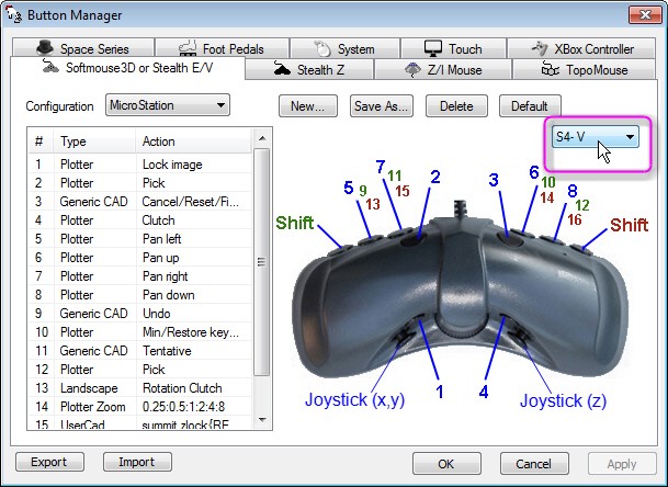
Stealth S4-V button diagram
Button Manager has a new Type=Plotter, Action=Terrain Vis Toggle. It has the same effect as “Hide/Show Contours” on the Terrain Visualization dialog.
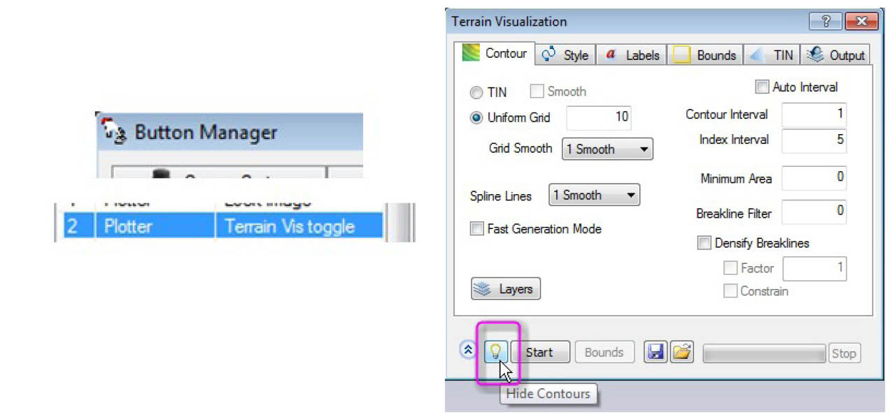
Button Manager’s new Terrain Visualization Toggle
LandScape
Surface Compare Color and Calculate Surface Compare are new “Color By” tools in LandScape. They color points based on the current comparison surface and create the surface comparison.
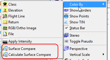
When viewing the comparison surface, gray indicates points that have not changed, blue indicates points that have the least amount of change, and red indicates points that have the most change. Save comparison surface to file may be used to save the comparison surface out to a .las file.
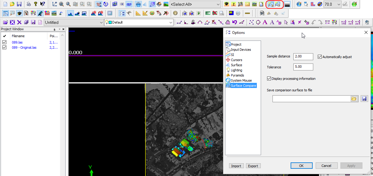
Color by Surface Compare Options and Main View in LandScape
Capture for ArcGIS
The Circle Drawing tool, which once only let you create flat simulated circles with every vertex at the same elevation, now has to option to create in 3D.
Automatic object and vertex selection (without snapping) has a larger selection tolerance. This will improve tools such as Edit Vertex in XY, XZY, and Z when snapping is off, because it will find the nearest object or vertex more reliably.
Capture for MicroStation
3DOFFSET now supports multiple offsets by loading a road configuration .rcfg file that was made earlier by ROAD SETTINGS.
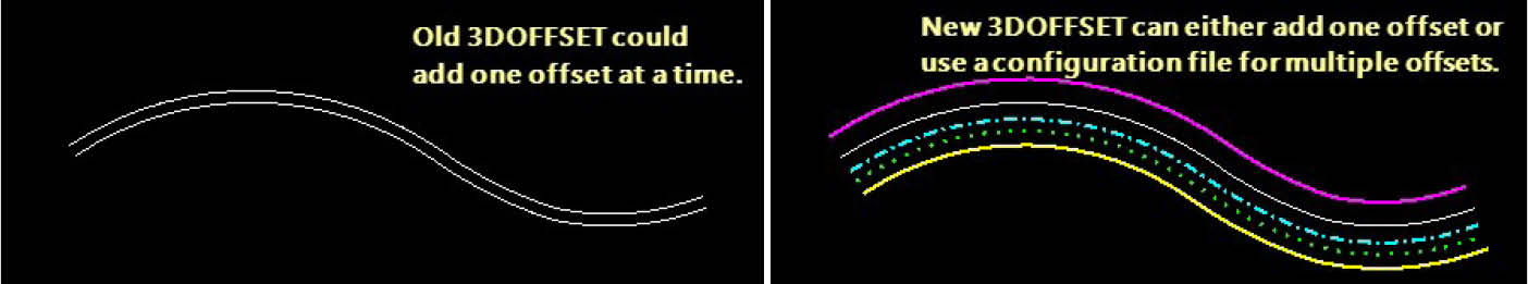
3DOFFSET road configuration offset options
Capture for AutoCAD
AutoCAD 2017 is now supported.
Capture for Global Mapper
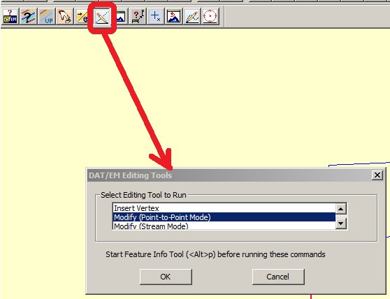
There are new DAT/EM Editing Tools for Global Mapper. These tools allow you to modify existing lines and areas.
The editing tools are as follows: Insert (Add) Vertex, Modify (Stream Mode), and Modify (Point-to-Point Mode). These are accessible from your choice of the DAT/EM Keypad, a digitizer button, or the Edit Tools button on the DAT/EM toolbar:
There are many more additions and bug fixes to the DAT/EM Photogrammetric Suite version 7.4. For a complete list, visit www.datem.com/release-notes. (requires current DAT/EM support password).
By Alissa Oder, DAT/EM Technical Support Manager
Comments are closed.