Tech Tip: Using Ground Rings or Ground Grids
How do you specify the size of a ground ring or ground grid to represent a hectare or other measurement?
A customer asked this question recently, and I thought it would be a good opportunity to share the information and review some of the handy tools available for the Summit Evolution cursor. This can be done in all the Summit editions: Professional, Feature Collection, Lite, Mobile, and UAS.
The customer’s task was to use Summit Evolution to determine tree density by counting trees in one-hectare sample areas. He wanted a visual clue to show the size of one hectare.
For this, we use either the cursor Ground Rings (for a circle) or Ground Grid (for a square).
For a square area, first translate a hectare to the units of your Summit project. Do a quick internet search such as “hectare to square meter converter” to find the conversion, and take the square root of the value to find the size of each side of the square you want:
• 1 hectare = 10000 square meters, which is a square of 100 meters per side
• 1 hectare = 107638.674 square U.S. Survey Feet, which is a square of 328.083 U.S. feet per side
• 1 hectare = 107639.104 square International Feet, which is a square of 328.084 International feet per side.
In Summit > Tools > Cursor > Ground Grid tab, you can set a 2 row x 2 column "Lines" grid with "Grid Size" set to 100m, 328.083 U.S. feet, or 328.084 International feet. You may also add a rotation:
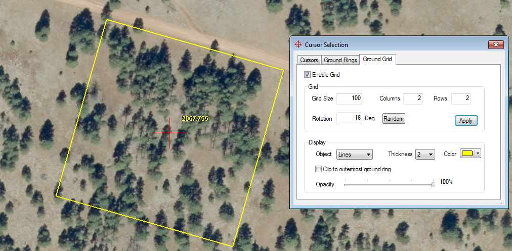
1 hectare Ground Grid area with rotation
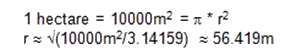
If you want a circle, determine what the radius would be and use Ground Rings instead. The area of a circle is π (pi) times the radius squared. You know the total area is a hectare, which is 10000 square meters, 107638.674 square U.S. Survey Feet, or 107639.104 square International Feet. Plug this into the equation for the area of a circle and solve for radius. For example, for meters:
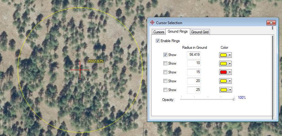
1 hectare ground ring demonstration
The cursor grid and rings are drawn in 2D at the elevation of the cursor. Keep in mind that it does not conform to the ground, so it will be less useful as an area indicator in steep terrain.
There are endless variations on this theme. For example, you could show four quarter-hectare regions or ten one-hectare regions by changing the settings in the Cursor Selection dialog.
-End-
Comments are closed.